Close

Our services

We will help you plan, implement and maintain the best City Wayfinding system to suit your city’s needs. We develop legible wayfinding basemaps, either as a seamless cartographic database in a GIS or as a file-based master basemap. From this core we create a range of map-based information products, including on-street pedestrian and cycle signs, printed posters displaying public transport information, temporary event wayfinding and interactive real-time transport information.

Our LLAMA platform manages the link between the wayfinding basemap and the information products on-street, helping you to maintain both effectively and retain value in the long term.

Wayfinding information products

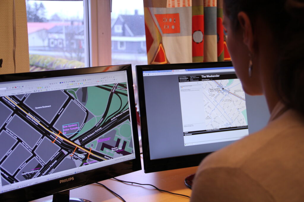
T-Kartor’s most successful City Wayfinding systems are shared resources, serving the needs of city marketing and tourism, public transport services and the wider regional transport system. We produce a range of information types from the same approved basemap and specialise in automated production for large quantities in a short time and at low unit costs.


Public transport

Public transport is better connected by providing maps which clarify access to the system while helping arriving passengers on their onward journey. These wayfinding products are usually displayed as posters, making use of existing infrastructure such as bus shelters or station poster frames. By integrating current service data we are able to automate the production of thousands of public transport maps, offering bus service maps at all bus stops across the system. 

Interactive digital wayfinding at transport interchanges help further by displaying real-time service information and directing people to the appropriate stop or entrance.
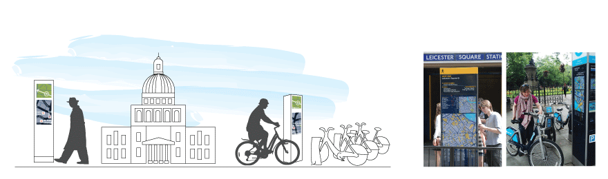
 

Walking and cycling

Pedestrian and cycle wayfinding encourages healthy, active mobility by placing signs at key decision points and along favourable walking routes. These sign types also serve public and regional transport by connecting walking and cycling with sustainable transport information. City marketing and tourism departments are served by highlighting what the city has to offer on the basemap.


Events wayfinding

Large scale events such as the Olympic Games, Commonwealth Games, Super Bowl and major conferences are supported by customising the core wayfinding basemap, and printing it on posters and hand-held paper maps.

Building the basemap

We build bespoke City Wayfinding basemaps to meet the city’s challenges, with all your wayfinding needs in mind. Multiple sources of data are used to create a detailed topographic base with legible walking environments. A network of stakeholders is used to curate map content, following a well established process. This ensures an accurate, authoritative basemap reflecting the unique character of each city.

We use the LLAMA platform to grow the basemap in the most effective way and are experienced in maintaining basemaps and wayfinding products. This is essential to ensure the wayfinding system’s continued value and growth in the future.

Automated Production

Our centralised, database-driven system efficiently combines, verifies and optimises geographic and transport service data. Whether adhering to recognised standards such as GTFS, or if entirely proprietary, your transport data is validated and optimised for use on wayfinding products at scale. Topographic data from multiple sources is conflated and harmonised, and points of interest data can be supplemented by our experienced field survey teams.

We provide a high degree of automation, keeping very large numbers of location-specific products in-sync. We employ ‘smart’ analysis to pinpoint exactly those signs and map products affected by changes to the basemap. This allows for cost effective and timely updates to user-facing information, ensuring your resources are only employed when and where necessary.

The results are clear, accurate, intuitive information products that integrate seamlessly with the public transport network while retaining the look and feel of your city and transport brand.

Follow City Wayfinding

Subscribe to our newsletter and get updates regarding City Wayfinding.

Learn more about our database driven system

See a collection of hand-picked blog articles describing our database driven system in detail

We use cookies in order to give you the best possible experience on our website. By continuing to use this site, you agree to our use of cookies.
Accept
Privacy Policy