
T-Kartor developed and maintains the world’s largest City Wayfinding systems (Legible London, WalkNYC and Toronto TO360) through a data-driven, core GIS (what is a GIS?) . This setup is also ideal for smaller cities such as Birmingham (UK) or Cleveland (Ohio). Here are six reasons why:
By saving the City Wayfinding basemap in a GIS database there is no limit to its size, now or in the future.
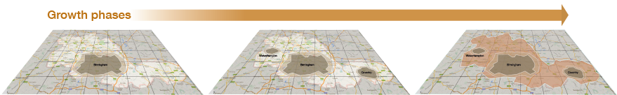
E.g: T-Kartor took over Birmingham city’s ‘Interconnect’ wayfinding project to expand the system from 3km² of the city centre to 25 km².
Creating different versions of the same basemap, with varying map designs for public transport, tourist information, shopping and sporting events would require four separate files, kept in sync to reflect changes on the street. The GIS stores only one version of each feature and applies the relevant style as each map is produced.
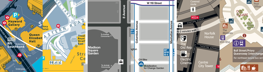
E.g. London, New York and Birmingham (Uk) City Wayfinding use two colour schemes (light on dark, dark on light). Maps of all styles are created from a single, maintained source.
Storing all map objects in a GIS allows the separation of content and style. Map content can then be checked and maintained constantly, ensuring accuracy and consistency of the basemap across all map information products.
Maps generated from a GIS are very easy to track by saving map frames within the system. We can then track creation date, customer ID, order number, operator; even the content of each map at the time it was produced.
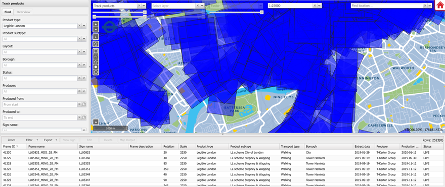
E.g. Our LLAMA online management portal enables ’Smart Refresh’ sign maintenance by intersecting changes in the basemap with existing map signs. Maintenance budgets are now directed to areas where they will have most effect.
T-Kartor’s City Wayfinding platform has been developed and enhanced over many years. Our GIS based tools for automating map outputs enable lower costs and higher volumes of wayfinding products.

E.g. In 2007 when Transport for London introduced cash-free buses, we automated 17,000 unique A4 bus stop maps showing the nearest ticket outlets.
A GIS-based system can be adapted to future digital services which are difficult to plan from the outset. This can include a WMTS (Web Map Tile Service), Integrated RTI (Real Time Information) data, new data layers such as cycle or accessibility infrastructure.
E.g. The wayfinding basemap is streamed to digital channels by preparing a Web Map Tile Service.