
Connecting cities is part of our history
T-Kartor City Wayfinding
T-Kartor City Wayfinding applies 30 years of cartographic and GIS experience to the modern challenge of helping people navigate cities in a sustainable way. We believe that cartographic information, served at the optimal time, position and via multiple channels, has the power to influence behaviour towards sustainable active mobility.
Our city wayfinding systems, including Legible London, Walk NYC and Toronto TO360, are based on a robust GIS platform to provide growth, value, system management and effective maintenance.
A background in public transport information
Launched in southern Sweden in 1985, T-Kartor has provided public transport information for Transport for London since 2000. We have innovated in this field with automated bus maps, vicinity maps and destination tables for UK public transport executives (PTEs) including Birmingham, Sheffield and Leeds, then internationally including Dublin and Paris.
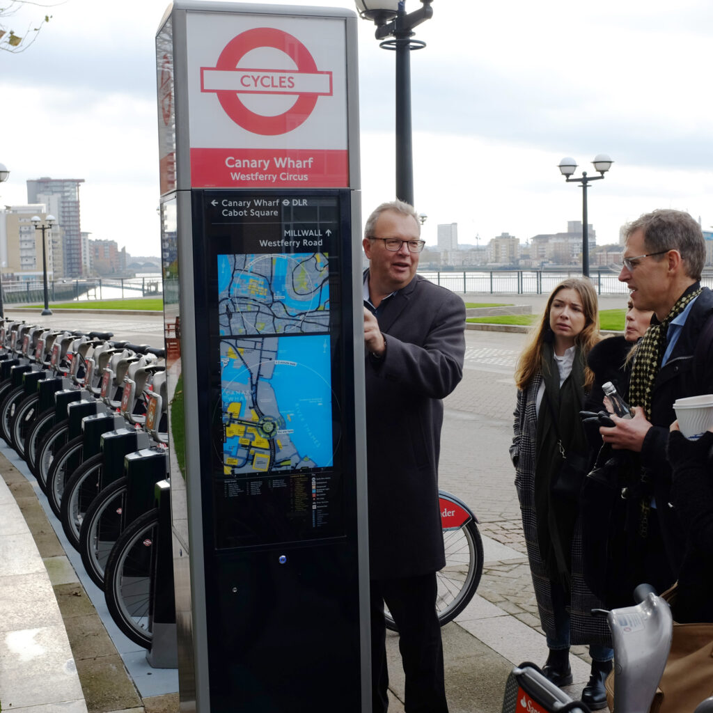
The Legible London wayfinding basemap marked a new era for us in 2009 when our data-driven methodology was required to produce a mapping system for the whole of Greater London to serve the London 2012 Olympic Games.
Our mix of cartographers, designers, GIS experts and programmers proved ideal to develop city wayfinding systems which combine design, cartography, data management, effective production and rigorous maintenance. We develop wayfinding systems for large cities (London, New York and Toronto) and small (Stockholm and Cleveland), often opening an office close to our customer to ensure a high level of service in the long term.
As innovators we respond to a rapidly evolving market by offering the latest interactive digital information while capturing the value of open data to provide mapping suited to a smaller budget.


What we do
T-Kartor City Wayfinding is part of T-Kartor Group, providing efficient solutions for security, big data management, sustainable mobility and much more. T-Kartor Group consists of the following companies:
T-Kartor Content Management focuses on state-of-the-art cartographic production and information optimized for every situation. We are proud to work with some of the most prestigious customers in the world. T-Kartor City Wayfinding creates mobility information and T-Kartor Defence delivers printed charts and enhanced digital rasters for Aeronautical, Hydrographic and Topographic information.
T-Kartor Geospatial focuses on developing data platforms and related applications using open source technology. They work with agile software development to provide technology as a licensed or cloud solution.
T-Kartor USA has several key defense contracts with the National Geospatial-Intelligence Agency (NGA) both as a prime contractor and with major partners. They also offer powerful data platforms and software applications within the federal market
Follow City Wayfinding
Subscribe to our newsletter and get updates regarding City Wayfinding.
Guide to cartographic design
Download our guide to cartographic design principles to learn more about the mapping behind a City Wayfinding system.