
Intuitive maps connecting the city
Why City Wayfinding
Reduced congestion
City wayfinding information encourages behavioural change by promoting walking, cycling and public transport. This will bring about modal shift away from private vehicle use, reducing congestion and thus benefiting the economy, improving air quality and reducing carbon emissions.
Connected public transport
Clear, consistent and intuitive wayfinding simplifies complex journeys and connects the first mile and last mile stages with the main public transport network. Maps are provided with up-to-date and highly accurate content, reassuring all who use them and building trust in the transport network.
Health and active mobility
City Wayfinding is an essential tool in promoting walking and cycling. Active forms of travel have been proven to improve physical and mental health with a quantifiable effect on the cost of healthcare within a city. In addition to the financial benefits, people will experience improved quality of life.
Improved public spaces for all
The city is constantly changing, and wayfinding information needs to keep pace. Improvements to the public realm and walking environments can be clearly shown as accessible and open to all, motivating exploration by bike or on foot and fostering a local sense of pride.
Economic activity
City Wayfinding helps drive footfall in key areas, encouraging visitors to stay longer and return again. It has been proved that increased walking benefits the local economy. At the same time wayfinding draws attention to the best a city has to offer, whether that be in retail, business or tourism.
Managing people movement
Large-scale events require the efficient and safe movement of large numbers of visitors who are not familiar with the surroundings. City Wayfinding principles help achieve this, evidenced by T-Kartor’s production of visitor and travel information for the London 2012 Olympic and Paralympic Games.
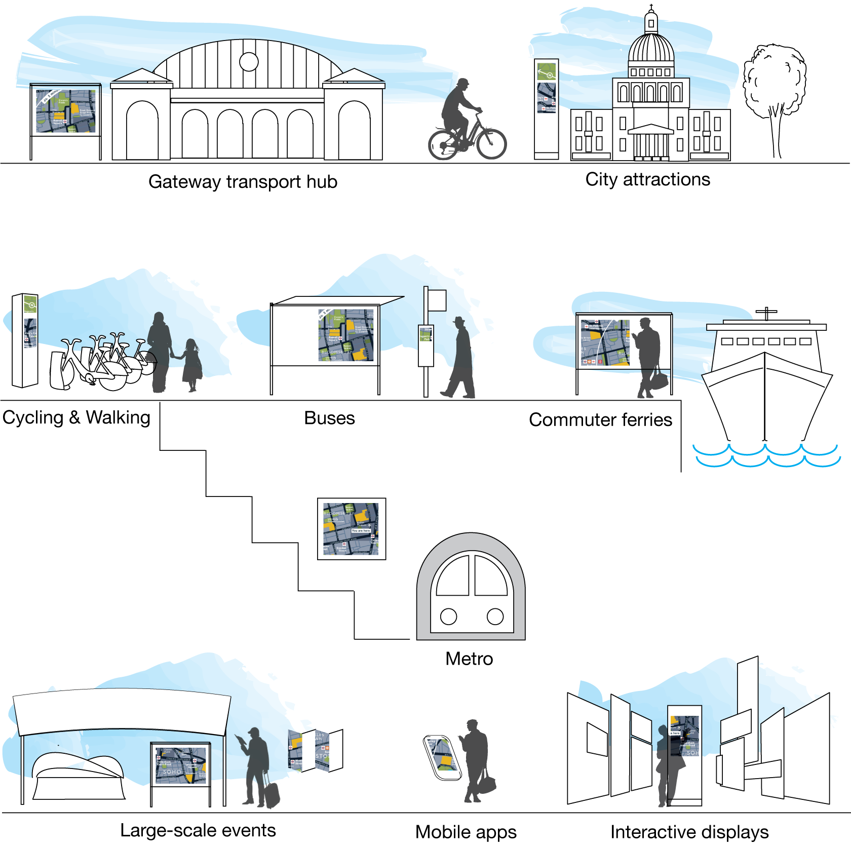
City Wayfinding provides legible and intuitive information to help people navigate the city, effectively connecting public transport to walking and cycling environments.
- ‘Heads-up’ map signs are rotated in the direction of travel to make map reading faster, easier and more accessible for everyone
- A 5-minute walking circle around the “You Are Here” position show what is available within a short walk
- Landmark building illustrations help create a ‘mental map’ of the surroundings and build a strong link between the map image and the real world
- Maps at two complementary scales provide street and footpath detail for precise journey planning and an overview of how this fits within a larger network
This improved information encourages active mobility.
Follow City Wayfinding
Subscribe to our newsletter and get updates regarding City Wayfinding.
Download our guide
See our guide for detailed examples of Wayfinding Information channels and uses.