
COVID-19 social distancing requires sidewalks that are wider than 2 metres (6ft). City Wayfinding systems based on GIS can help analysis, planning and informing the public.
There has always been pressure on the shared space of the sidewalk: for deliveries, parking, access to public transport and cycling, not to mention walking! With emergency COVID-19 requirements for social distancing, a new pressure has arisen. Studies show that in many cases sidewalks are not wide enough to accommodate the regulated social distancing.
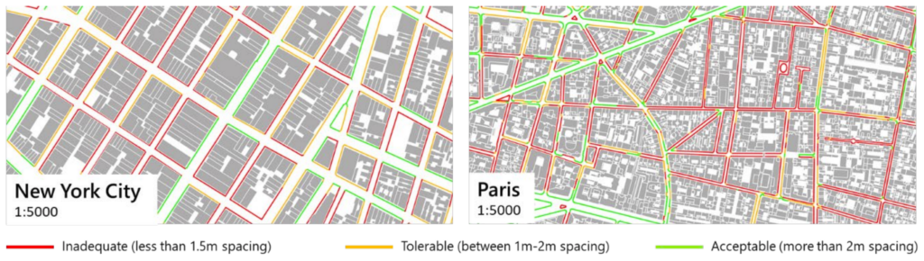
Source: International Transport Forum / Github / Meli Harvey
This study, by ESRI UK and Ordnance Survey, highlights the problem of unsafe sidewalks in major cities, finding that only 30% of Great Britain’s pavements are at least 3m (9ft) wide, 36% are between 2 and 3m (6-9ft) and 34% are less than 2m (6ft) wide. The problem is exacerbated where restricted access to shops requires queuing.
Combining sidewalk data with a City Wayfinding system built on a GIS core could provide powerful opportunities for analysis, planning and information provision, with a very short turn-around time. This can be crucial to communicate an ever changing picture of public regulations and advice.
An example of applying sidewalk data to a wayfinding system is already underway in Toronto.
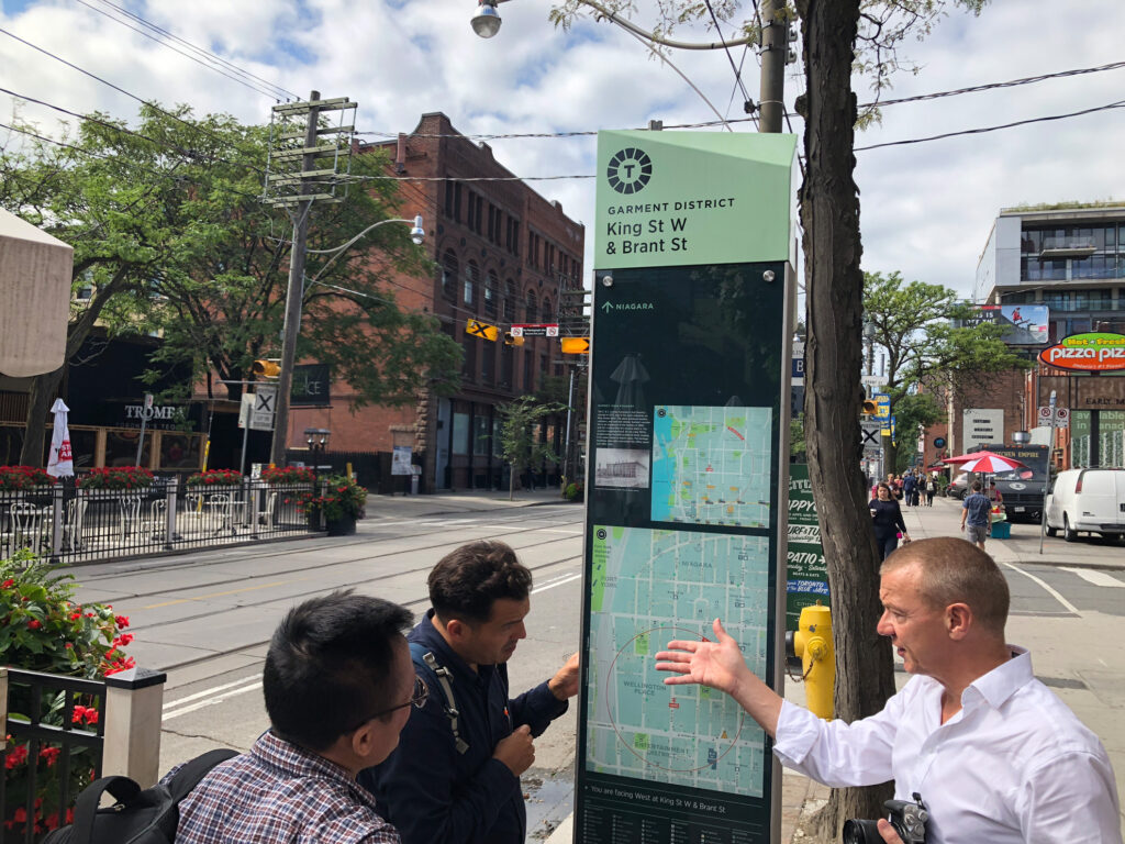
Toronto TO360 Wayfinding system
As part of the Toronto TO360 wayfinding system, T-Kartor are carrying out a sidewalk inventory (the Pedestrian Inventory Network: PIN) which was designed to provide accessibility data in a practical way via the wayfinding database.
The PIN dataset extends City of Toronto’s wayfinding database by providing an inventory of walkable pedestrian space for the whole of Toronto. Knowing where sidewalks, crosswalks, paths and trails exist (or do not) and their accessibility characteristics (slope, steps and barriers), will help inform better decision-making regarding pedestrian space. Comprising a joined-up network, the PIN also supports routing, which will enable the creation of digital applications for wayfinding.
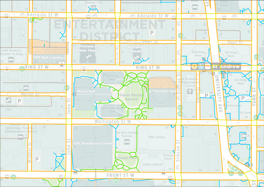
The Toronto TO360 Pedestrian Inventory Network
T-Kartor creates ‘data-driven’ City Wayfinding systems based on a GIS core. In contrast to common systems comprising disparate map files cut from a single ‘master’ file, our maps are generated directly from a GIS database. The data is kept up-to-date and checked for accuracy, and maps are created and styled as required from layers relevant to the particular map type. New types of map are available by simply including new layers (e.g. sidewalk inventory), leaving all data intact.
The core data-driven wayfinding system approach offers a real opportunity for innovation in current information provision, offering wider applications..
The Wayfinding GIS can be analysed and applied to pedestrian wayfinding maps to show safe sidewalks (either for social distancing or accessibility) and sidewalks to be avoided.
As a joined up network of pedestrian spaces, the PIN can be used for route planning. For example, an app can be developed using the data to display a wayfinding map showing safe walking routes e.g. from the station to a shopping centre.
In order to influence people’s behaviour during emergencies such as a pandemic, clear, reliable information must be made available. Mobile phone apps cannot be relied upon solely for such public service information. A data-driven wayfinding system enables the creation of accurate, legible printed maps reflecting the latest, accurate data, in a very short space of time.
To read more about the versatility of map products available from a core GIS Wayfinding System, download our guides.