
A significant investment in wayfinding signage is rolled out across the most visited areas of your city, connecting access to all modes public transport. A grand achievement and a huge facelift for the city. Then from day one begins a slow process of entropy unless processes are put in place to maintain the signs and update the information at regular intervals.
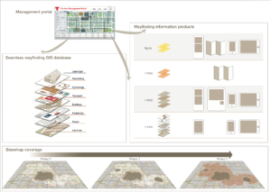
Over the past ten years T-Kartor has developed routines for the smooth and continuous management of over 10,000 information products across London. The same online management platform is used across all our city projects, large (Toronto, New York, Paris) and small (Cleveland, Stockholm). Here are some of the key success factors to consider when planning system management and governance.
Gatekeeper
The city or public transport organisation responsible for wayfinding system maintenance should provide a Gatekeeper for the lifetime of the system. This role involves coordinating stakeholder input and taking decisions about basemap content, ensuring that rules are applied consistently. The Gatekeeper also manages the budget for information product updates, allocating it in the best way possible to maximise the impact of the maintenance budget.
Online management platform
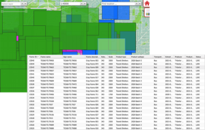
T-Kartor’s online management platform allows communication with stakeholders whose input is invaluable for updating the basemap. Via the same portal the Gatekeeper approves and oversees basemap updates carried out in the core GIS, ordering updates to on-street products using an asset management overview. The platform simplifies the planning of product updates and allocation of resources, as well as placing orders with the mapping provider and printer.
Shared resources
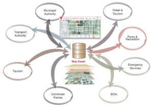
A single core basemap for a multitude of product types, both print and digital, creates an ideal shared resource which can be accessed by many departments from the city administration to regional transport operators. The cost of maintaining the basemap can be shared across all users of the system in relation to the information types and volumes being created.
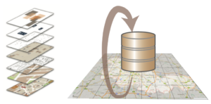
Continuous basemap updates
Many cities initially underestimate the rate of change of infrastructure, and may not plan basemap updates from the outset. However, we have found that a yearly subscription, proportional to the size and complexity of the basemap, is a more efficient and often cheaper way to budget for maintenance than to wait for a large scale infrastructure change, such as a new tram route, to trigger a major refresh of all information.
Smart refresh of public facing products
Our platform analyses the distribution of map products and the impact of basemap updates to recommend a priority list for refreshing wayfinding signs. This allows considerable savings by allocating resources to where they are needed most, rather than a blanket refresh of all signs across the system.
To safeguard against entropy and decay we recommend well planned, continuous maintenance of the wayfinding system and its shared resources. Clearly allocated responsibilities and targeted, high impact product updates are examples of how to help City Wayfinding systems to thrive and grow in value over time.
To learn more and discuss examples from specific cities, feel free to book a demo of the LLAMA platform.