
A City Wayfinding system, with a basemap stored in a data-driven GIS platform, is very adaptable to new products and uses. It makes an ideal mapping resource to be shared across multiple departments and organisations, adding value and increasing return on investment. Every new product to be created based on the wayfinding basemap uses the latest, updated and approved version of the map.
Here are some examples from T-Kartor’s customers in Birmingham (UK), Cleveland, London, Toronto and New York.
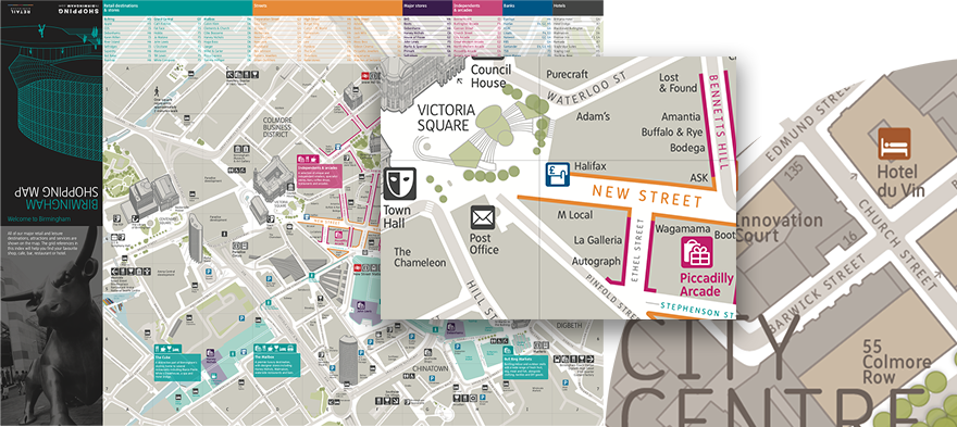
This fold-out shopping map was created covering Birmingham City Centre as a guide to visitors describing the shopping opportunities the city has to offer.
It is based on the pedestrian wayfinding basemap (right inset) with reduced detail, lighter colours and shopping data overlays. The product is updated and reprinted yearly to reflect updated shopping data and a link to the wayfinding database ensures use of the continuously updated basemap.
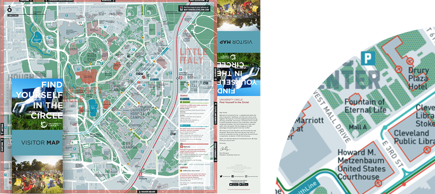
Destination Cleveland is responsible for stimulating the local economy which thrives due to 16 million visitors annually to the Convention Centre.
Seamless Cleveland was designed to create a positive welcome for visitors, connecting parts of the city and tapping into Cleveland’s brand.
The wayfinding system consists of 100 pedestrian signs and 10-15 printed publications, refreshed annually. Many bespoke maps are produced in connection with ongoing conferences.
This product is a visitor map for the University Circle.
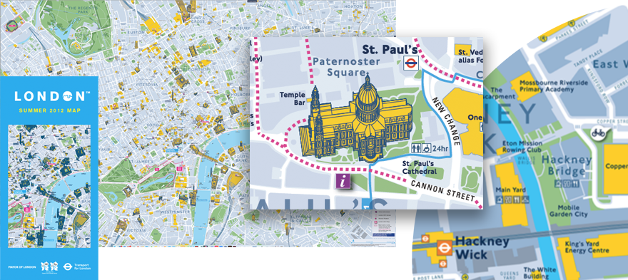
In 2012 London hosted the Olympic Games, which meant a mammoth organisational operation for Transport to London, as 5 million daily commuting journeys would double for two weeks.
The Legible London database was rolled out to cover the whole of Greater London to coincide with the Olympic Games, as venues were dispersed and not always close to the tourist attractions visitors are familiar with.
Hundreds of bespoke wayfinding information products were created from Legible London to ease and influence the movement of visitors. Among the most successful was this Host City Map covering the popular tourist sites at a suitable scale for pedestrian wayfinding, with inset maps and an overview on the reverse side to link venues with the centre.
A map of this size and detail was only possible within the short time period as the Legible London database was being kept current and accurate, and the system was capable of exporting this large area to one print file.
The Host City Map was distributed as a free leaflet in 5 million copies.
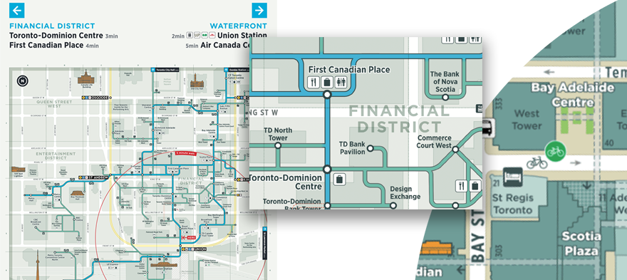
The PATH is a mostly underground pedestrian walkway network in downtown Toronto that spans more than 30 kilometres of restaurants, shopping, services and entertainment. The walkway facilitates pedestrian linkages to public transit, accommodating more than 200,000 business-day commuters as well as tourists and residents. The PATH provides an important contribution to the economic viability of the city’s downtown core.
A special version of Toronto’s TO360 basemap (inset right) was created to help people navigate the network and feel orientated to the reality above ground.
Using the TO360 Wayfinding basemap as a background to the PATH map ensures that updates can be created at regular intervals while including the latest version of the (above ground) wayfinding basemap.
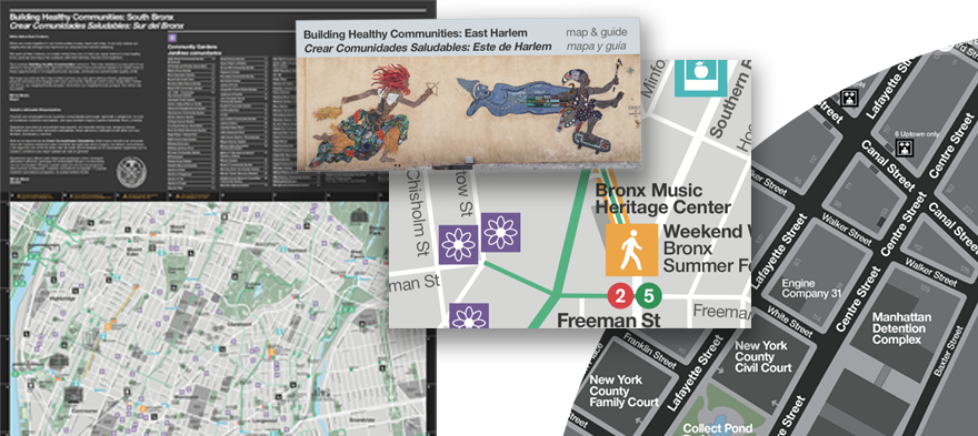
For the Mayor of New York, the WalkNYC City Wayfinding system was not aimed solely at tourists in Manhattan. The system was implemented across all 5 New York boroughs. One of the map products created from the system was the Building Healthy Communities map, a fold-out guide for local residents to highlight local farmers’ markets, public gardens and parks, public artworks, urban farms and weekend walks.
These themed maps were developed to improve citizens’ sense of belonging, awaken a curiosity to explore the local surroundings and improve health. The popular map products were created for East Harlem, South Bronx and Brownsville.
—
All the above special purpose products were created from a T-Kartor City Wayfinding basemap by adding various overlays of information, and adjusting map colours to match the new product design. Updates of the map products apply the new style while using the latest updated basemap.