Ireland National Transport Authority
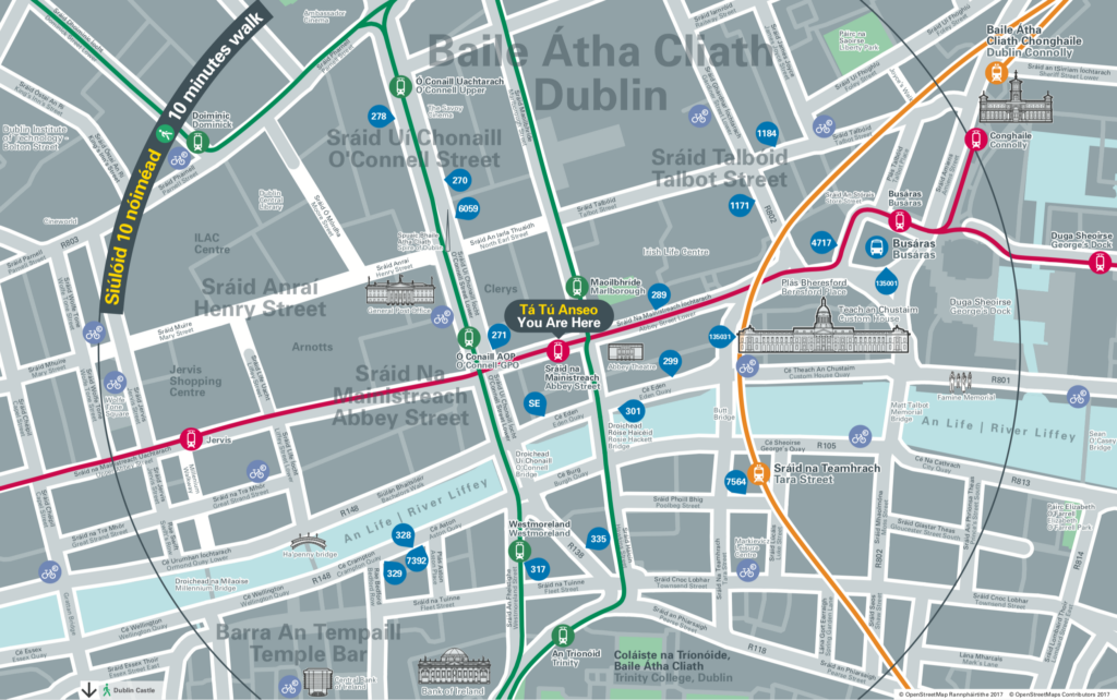
Ireland’s National Transport Authority completed the extension of its LUAS Cross City tram line at the end of 2017. To coincide with the launch T-Kartor were asked to provide vicinity maps for each of the 67 stations, based on OpenStreetMap data and the NTA’s existing map specification.
Having created a basemap and a number of bus network maps for Dublin Bus the previous year, we were familiar with Dublin’s public transport data and graphic specifications. We are also very experienced with OpenStreetMap data and set about analysing the data available for Dublin.
OpenStreetMap data was used as a base, styled to match existing bus map products. The original Dublin Bus basemap, however, did not accommodate for dual language, which is a requirement for the NTA. We tested the tolerances of road widths at different scales in order to find the optimal design to fit English and Gaelic street names beside each other using legible point sizes.
67 Luas system vicinity maps centred on each tram stop, showing places of interest and landmark buildings on the dual-language base, and transport data overlays showing tram routes, tram stops and bus stops.