
According to David Gilbert, President and CEO of Destination Cleveland:
“We’ve done a great job as a community to strengthen Cleveland as a destination by implementing nearly $3 billion in visitor-related development. It is equally important that we now invest in enhancing the visitor experience by better connecting these assets.”
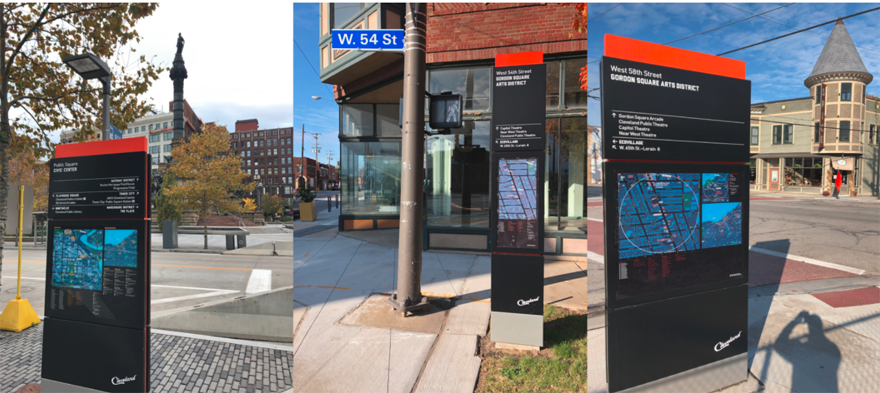
Seamless Cleveland is a wayfinding system with street signs, transit integration and an online mapping tool. It was devised in 2013 by our partners, Applied Wayfinding to deliver seamless journeys via a comprehensive approach to wayfinding that crosses neighbourhood and city boundaries.
T-Kartor recently migrated the Seamless Cleveland basemap onto our wayfinding platform and now maintain the core GIS basemap in order to update over 200 maps promoting the city to 16 million visitors annually.
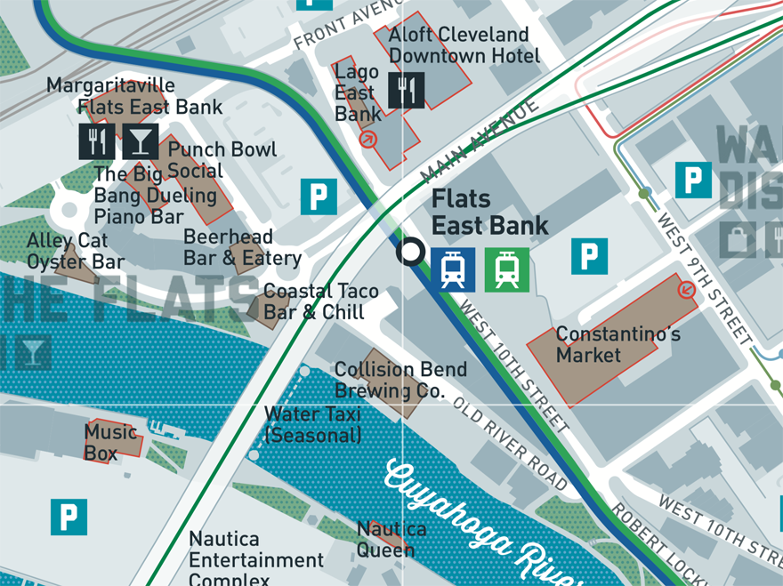
Beyond the on-street map signs the system includes a host of specific map products to promote businesses and stimulate the visitor-based economy:
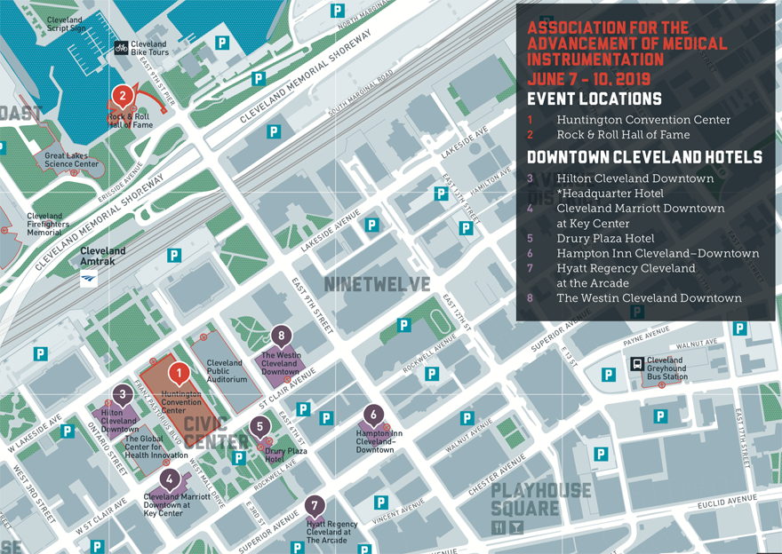
Cleveland is a popular destination thanks to its Huntington Convention Centre. A map is produced specifically for ongoing events, such as this example for the Association for the Advancement of Medical Instrumentation. Important information layers include the position of local hotels, restaurants and venues where various networking events are held and attractions for attendees to visit on their time-off.
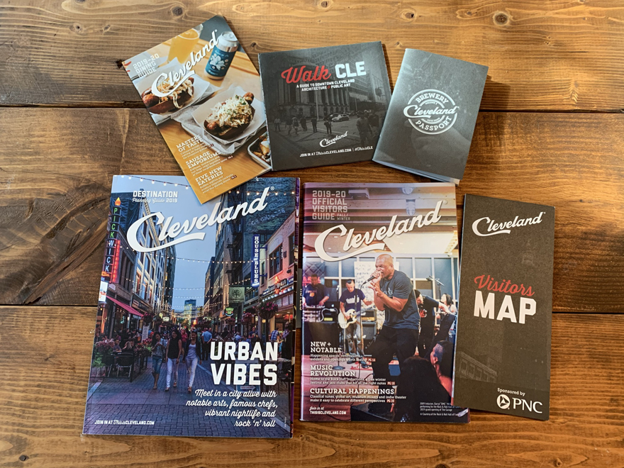
A comprehensive dining guide is one of a host of downloadable themed maps available on the thisiscleveland.com website.
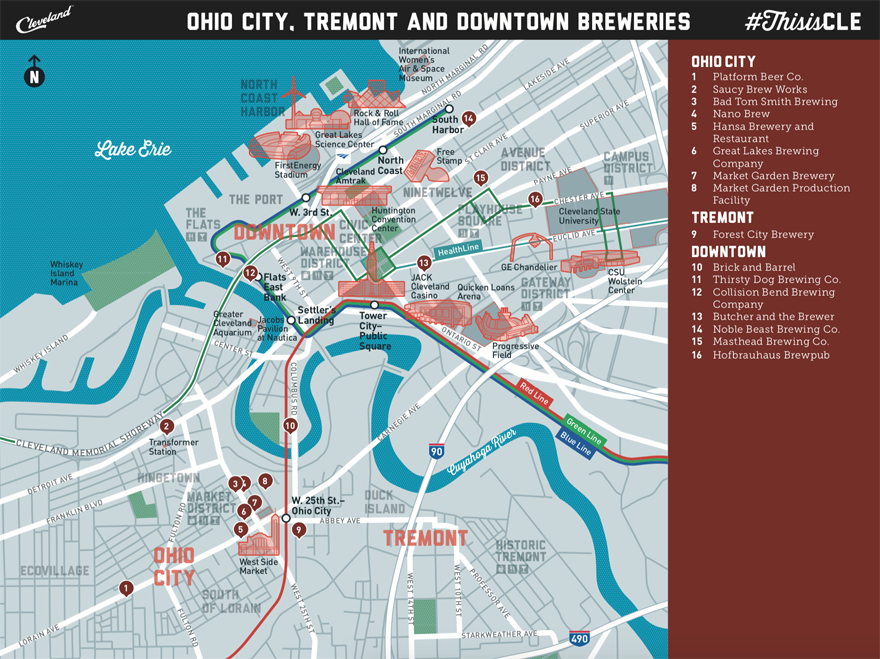
Another popular themed map is the brewery guide which highlights 16 independant breweries in the city and 20 more county-wide.
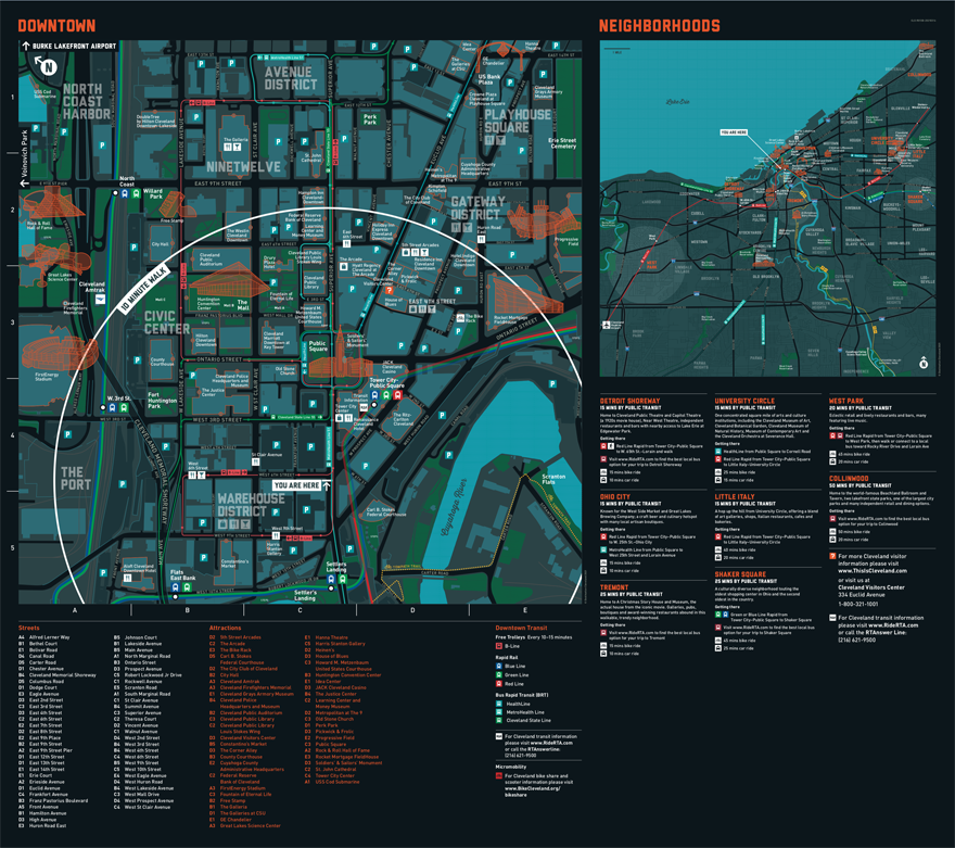
A network of popular on-street wayfinding signage feature landmark building illustrations, a 10-minute walk circle and rotated to the direction ahead form the core of the system. These are intended to help visitors to figure out what to see, do and eat, and how to get there.
This system overview, from T-Kartor’s online LLAMA portal, shows map products in their geographical position:
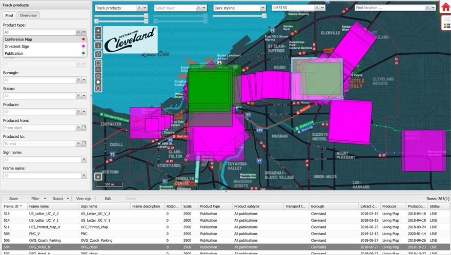
As the US economy is starting a trajectory of recovery following a COVID-induced hiatus, Destination Cleveland are updating their wayfinding information. The LLAMA portal helps to assess which maps are in need of refreshing, currently about half of the on-street signs and almost all printed products.