Close

LLAMA City Wayfinding platform

COLLABORATE

IMPLEMENT

MAINTAIN

T-Kartor’s wayfinding platform

A City Wayfinding system is complex, with a hundred or more overlapping maps from the same master basemap at slightly different rotations, often using different styles for specific situations. As new stakeholders (from public transport, cycling, tourism, events and business) increase demand, new signs are added and a greater area of coverage. All this information must be managed and kept up to date in the long term.

T-Kartor implements and maintains the world’s largest and best known City Wayfinding systems. Our LLAMA City Wayfinding platform makes the complexities of your wayfinding system clear and manageable, with a geographic visualisation providing the perfect overview of all your wayfinding assets.

LLAMA packages decades of experience to guide users through all the necessary stages of designing, implementing and maintaining a robust City Wayfinding system, with intuitive tools to manage each stage:

COLLABORATE

  • Foster project champions by sharing access to the portal as the basemap is developed. Show basemap progress as the basemap grows and new products are installed on-street
  • Collate stakeholders’ contributions for everything from content selection to proofreading, with comments saved in position on the master basemap
  • Allow individual levels of access to project members with varying responsibilities
  • Share all project files in one place (e.g. print files), and link them to the map where required

IMPLEMENT

  • Plan the distribution and roll-out of signs directly in the portal, by placing and rotating map frames, choosing between product types and outputting a draft version
  • Store all product type templates and design guidelines in one place to ensure consistent information across all the city’s wayfinding maps
  • Create automated and semi-automated map outputs, allowing simpler edits to be carried out in-house and affording economies of scale for large production batches
  • Download short-notice diversion maps for emergency travel disruptions
  • Visually track the progress of sign installations and updates to the basemap

MAINTAIN

  • Manage all your information assets from the portal with a geographic overview and visual record of each product
  • Track changes in the basemap and link these to products affected
  • See the current print file associated with each information asset
  • Create a sign maintenance regime using ‘Smart Updates’, directing resources where they will add most value
  • Check information overlaps for consistency

Our services

Using the LLAMA platform we will help you manage the design process, organise stakeholders and plan the best City Wayfinding system to suit your city’s needs. We build robust City Wayfinding basemaps, either as a seamless cartographic database in a GIS or as a file-based master basemap. We then create a range of map-based wayfinding products, including on-street pedestrian and cycle signs, printed posters displaying public transport information, temporary event wayfinding and interactive real-time transport information.

Our LLAMA platform manages the link between the wayfinding basemap and the information products on-street, helping you to maintain both effectively and retain value in the long term.

Wayfinding information products

T-Kartor’s most successful City Wayfinding systems are shared resources, serving the needs of city marketing and tourism, public transport services and the wider regional transport system. We produce a range of information types from the same approved basemap and specialise in automated production for large quantities in a short time and at low unit costs.

Walking and cycling

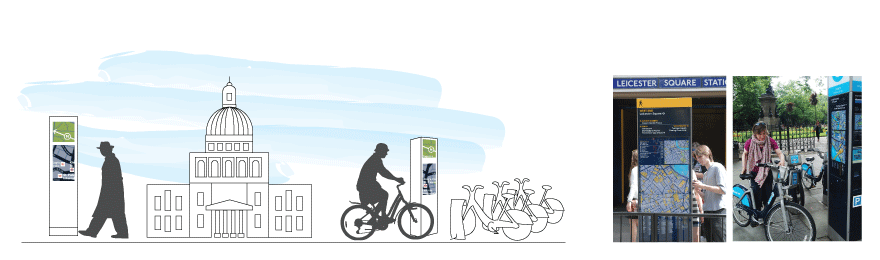
Pedestrian and cycle wayfinding encourages healthy, active mobility by distributing signs at key decision points and along favourable walking routes. These sign types also serve public and regional transport by connecting walking and cycling with sustainable transport information. City marketing and tourism departments are served by highlighting what the city has to offer on the basemap.

Public transport

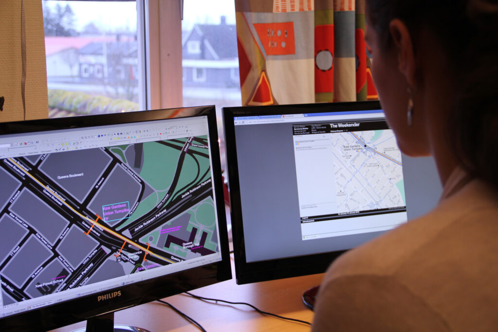
Public transport is better connected by providing maps which clarify access to the system while helping arriving passengers on their onward journey. These wayfinding types can be printed on posters, making use of existing infrastructure such as bus shelters or station poster frames. Using current service data we are able to automate the production of public transport information, for example to produce bus service maps at all bus stops across the system. 

Interactive digital wayfinding at transport interchanges help further by displaying real-time service information and directing people to the appropriate stop or entrance.

Events wayfinding

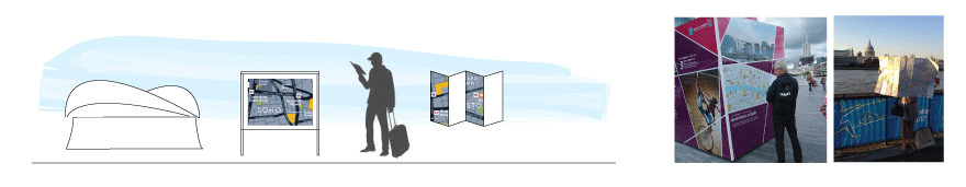
Temporary events such as the Olympic Games, Commonwealth Games, Super Bowl and larger conferences can be supported by customising the same wayfinding basemap, printed on posters and hand-held paper maps.

Building the basemap

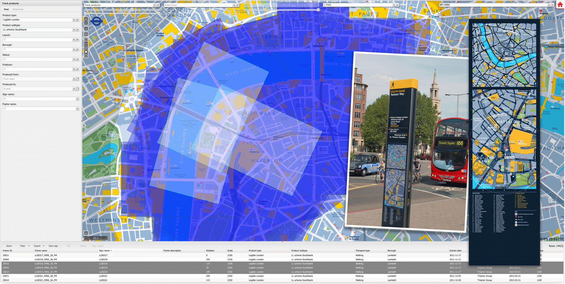
We build bespoke City Wayfinding basemaps to meet the city’s challenges, with all your wayfinding needs in mind. Multiple sources of data are used to create a detailed topographic base with legible walking environments. A network of stakeholders is used to curate map content, following a well established process. This ensures an accurate, authoritative basemap reflecting the unique character of each city.

We use the LLAMA platform to grow the basemap in the most effective way and are experienced in maintaining basemaps and wayfinding products. This is essential to ensure the wayfinding system’s continued value and growth in the future.

Follow City Wayfinding

Subscribe to our newsletter and get updates regarding City Wayfinding.

Learn more about our database driven system

See a collection of hand-picked blog articles describing our database driven system in detail

We use cookies in order to give you the best possible experience on our website. By continuing to use this site, you agree to our use of cookies.
Accept
Privacy Policy